Status of monument -> National monument
Pursuant
to Article V para. 4 Annex 8 of the General Framework Agreement for Peace in Bosnia and Herzegovina
and Article 39 para. 1 of the Rules of Procedure of the Commission to Preserve
National Monuments, at a session held from 6 to 8 November 2012 the Commission
adopted a
D E C I S
I O N
I
The
historic site of the necropolis with stećak tombstones at Crnač in Donja
Kotorac, Municipality East Ilidža, is hereby designated as a National Monument of Bosnia and Herzegovina (hereinafter: the
National Monument).
The
National Monument consists of 54 stećak tombstones.
The
National Monument is located on a site designated as cadastral plot no. 1839
(new survey), corresponding to c.p. nos. 154/1 and 155 (old survey), title deed
no. 661/2, Land Register entry no. 8051, cadastral municipality Gornji Butmir,
and c.p. nos. 1253 and 1257/1 (new survey), c.m. Vojkovići, corresponding to
c.p. 154/2 (old survey), Land Register entry no. 3709, c.m. Gornji Butmir,
Municipality East Ilidža, Republika Srpska, Bosnia and Herzegovina.
The
provisions relating to protection measures set forth by the Law on
Implementation of the Decisions of the Commission to Preserve National
Monuments, established pursuant to Annex 8 of the General Framework Agreement
for Peace in Bosnia and Herzegovina (Official Gazette of Republika Srpska no.
9/02, 70/06 and 64/08) shall apply to the National Monument.
II
The
Government of Republika Srpska shall be responsible for providing the legal,
scientific, technical, administrative and financial measures necessary for the
protection, conservation and presentation of the National Monument.
The
Commission to Preserve National Monuments (hereinafter: the Commission) shall
determine the technical requirements and secure the funds for preparing and
setting up signboards with basic details of the monument and the Decision to
proclaim the property a National Monument.
III
To ensure
the on-going protection of the National Monument on the area defined in Clause
1 para. 3 of this Decision, the following measures are hereby
prescribed;
-
all works are prohibited
with the exception of investigative and conservation works, routine maintenance
works, and works designed to present the monument, with the approval of the
ministry responsible for regional planning in Republika Srpska (hereinafter:
the relevant ministry) and under the expert supervision of the heritage
protection authority of Republika Srpska (hereinafter: the heritage protection
authority);
-
works may be carried out
on the infrastructure subject to the approval of the relevant ministry and the
expert opinion of the heritage protection authority;
-
the refurbishment of the
necropolis and repairs to any damage are permitted solely subject to first
drawing up a plan for repairs, restoration and conservation and to the approval
of the relevant ministry, and under the expert supervision of the heritage
protection authority;
-
the removal of the
tombstones from the graves to any other location is prohibited;
-
the removal of lichen and
moss from the stećaks is prohibited;
-
by way of exception to the
above provision, the stećaks may be cleaned if required to examine the
epigraphic or decorative features of a stećak, subject to first compiling a
report and obtaining the approval of the entity ministry responsible for
regional planning. The report should be based on such biological, chemical,
physical and other analyses as a conservator considers necessary, and should
include appropriate conservation measures and an assessment of the impact of
cleaning methods on the stone;
-
the area is an
archaeological site, and investigative works must therefore be carried out in
the presence of an archaeologist;
-
the site of the monument
shall be open and accessible to the public, and may be used for educational and
cultural purposes;
-
the dumping of waste is
prohibited.
The
Government of Republika Srpska shall be responsible in particular for ensuring
that the following protection measures are carried out:
-
conducting a geodetic survey
of the National Monument;
-
producing a project for
the repair, restoration and conservation of the National Monument, with a
preliminary survey of its current condition in order to determine the type and
extent of threats to the site and damage to the monuments;
-
producing a programme for
the routine maintenance of the monument.
IV
All
movable artefacts found during the course of the archaeological survey shall be
deposited in the nearest museum able to provide the necessary personnel,
material and technical conditions or in the National Museum of Bosnia and
Herzegovina in Sarajevo,
catalogued, and suitably presented.
All
movable and immovable archaeological material found during the course of the
archaeological investigations shall be professionally catalogued.
Upon
completion of the archaeological works the archaeologist leading the
investigations shall submit a report to the Commission and to the institution
that conducted the investigations.
The
archaeologist leading the investigations must have access to all the movable
and immovable archaeological material found during the course of the
investigations and until his/her report is completed, for a period not
exceeding three years.
All
immovable finds shall be conserved in situ as the archaeological investigations
proceed, and the movable archaeological material shall be conserved and placed
for safe keeping in a suitable storage facility.
Upon
receipt of a report on the investigations conducted, the Commission shall
identify which movable artefacts shall be subject to protection measures to be
determined by the Commission.
The
removal of the movable artefacts referred to in para. 1 of this Clause from Bosnia and Herzegovina
is prohibited.
By way of
exception to the provisions of para. 7 of this Clause, the temporary removal
from Bosnia and Herzegovina of the movable artefacts for the purposes of
display or conservation shall be permitted if the leader of the investigations
determines that a given artefact must be catalogued abroad, and provides evidence
to that effect to the Commission, which may permit the temporary removal of the
artefact from the country subject to detailed conditions for its export,
treatment while out of the country and return to Bosnia and Herzegovina.
V
All
executive and area development planning acts are hereby revoked to the extent
that they are not in accordance with the provisions of this Decision.
VI
Everyone,
and in particular the competent authorities of the Republika Srpska, and urban
and municipal authorities, shall refrain from any action that might damage the
National Monument or jeopardize the preservation and rehabilitation thereof.
VI
The
Government of Republika Srpska, the Ministry responsible for regional planning
in the Republika Srpska and the heritage protection authority of the Republika
Srpska, and the Municipal Authorities in charge of urban planning and land
registry affairs, shall be notified of this Decision in order to carry out the
measures stipulated in Articles II – V of this Decision, and the Authorized
Municipal Court shall be notified for the purposes of registration in the Land
Register.
VII
The
elucidation and accompanying documentation form an integral part of this
Decision, which may be viewed by interested parties on the premises or by accessing
the website of the Commission (http://www.kons.gov.ba).
VIII
Pursuant
to Art. V para. 4 Annex 8 of the General Framework Agreement for Peace in Bosnia and Herzegovina,
decisions of the Commission are final.
IX
This
Decision shall enter into force on the day following its publication in the
Official Gazette of BiH.
This
Decision has been adopted by the following members of the Commission: Zeynep
Ahunbay, Martin Cherry, Amra Hadžimuhamedović, Dubravko Lovrenović and Ljiljana
Ševo.
No: 05.2-2.3-73/12-33
6 November 2012
Sarajevo
Chair of
the Commission
Ljiljana
Ševo
E l u c i
d a t i o n
I – INTRODUCTION
Pursuant
to Article 2, paragraph 1 of the Law on Implementation of the Decisions of the
Commission to Preserve National Monuments, established pursuant to Annex 8 of
the General Framework Agreement for Peace in Bosnia and Herzegovina, a
“National Monument” is an item of public property proclaimed by the Commission
to Preserve National Monuments to be a National Monument pursuant to Articles V
and VI of Annex 8 of the General Framework Agreement for Peace in Bosnia and
Herzegovina and property entered on the Provisional List of National Monuments
of Bosnia and Herzegovina (Official Gazette of BiH no. 33/02) until the
Commission reaches a final decision on its status, as to which there is no time
limit and regardless of whether a petition for the property in question has
been submitted or not.
On 30
December 2009 Senad Kuč, history teacher and employee of the Sarajevo Museum
at the Despić House, submitted a proposal/petition to designate the necropolis
of stećaks at Crnač in Vojkovići, East Ilidža, as a national monument of Bosnia
and Herzegovina.
Pursuant
to the provisions of the law, the Commission proceeded to carry out the
procedure for reaching a final decision to designate the Property as a National
Monument, pursuant to Article V, para. 4 of Annex 8 and Article 35 of the Rules
of Procedure of the Commission to Preserve National Monuments.
Statement of Significance
Historical
facts relating to the territory ruled by the Pavlović family suggest that the
Crnač necropolis fell within their lands in Vrhbosna and Tilava counties. Reference
works record that the remains of Roman building material from a Roman building
have been found on the site. The site also contains a necropolis with stećak
tombstones, 51 chest-shaped and three gabled or sarcophagus-shaped. The graves
with stećaks form three groups, lying southwest-northeast, west-east and
northwest-southeast. They are undecorated, but gabled tombstone no. 6 bears an
epitaph on the “roof”, reading † “Here lies Vogčinь (Bogčinь), son of prince
Stipko U[garьč]ić, on his noble land. Friend, pity me. I departed this life
young, and was my mother’s only [son]. Written by Ugarakь.”
The
necropolis dates from the mid 14th to the latter half of the 15th century.
II – PRELIMINARY PROCEDURE
In the
procedure preceding the adoption of a final decision to proclaim the property a
national monument, the following documentation was inspected:
-
details of the current
condition and use of the property, including a description, architectural
survey and photographs
-
an inspection of the
current state of the property
-
a copy of the cadastral
plan
-
a copy of the Land
Register entry
-
historical, architectural
and other documentary material on the property, as set out in the bibliography
forming part of this Decision
Pursuant
to Article V para. 2 of Annex 8 of the General Framework Agreement for Peace in
Bosnia and Herzegovina and Article 37 of the Rules of Procedure of the
Commission, before rendering a final decision designating a property as a
national monument, the Commission is required to provide the owner of the
proposed monument, the person submitting the petition, the institutions
responsible for heritage, professional and academic institutions, experts and
scholars, as well as other interested parties, to express their views. The
Commission received the petition on 30 December 2009.
Accordingly,
the Commission issued the following letters:
-
letter ref.
05.2-35.2-5/12-161 dated 4 September 2012 requesting documentation and views on
the designation of the necropolis with stećaks at Crnač in Vojkovići, East
Ilidža Municipality as a national monument of Bosnia and Herzegovina to East
Ilidža Municipality (Mayor), Department responsible for urbanism and cadastral
affairs, the Ministry of Regional Planning, Construction and the Environment of
Republika Srpska, the Institute for the Protection of the Cultural and Natural
Heritage of Republika Srpska, the Institute for the Protection of Monuments
under the Federal Ministry of Culture and Sport, the National Museum in
Sarajevo, the Cantonal Institute for the Protection of the Cultural and Natural
Heritage of Sarajevo, and the Sarajevo Museum.
-
letter ref. 05.2-35.2-19/12-31
of 4 September 2012, supplying East Ilidža Municipality, department responsible
for urbanism and cadastral affairs, with a Public Invitation to the Owner(s) of
the land on which the necropolis with stećaks at Crnač is located, with a view
to obtaining their views, remarks and suggestions in writing concerning the
designation of the property as a national monument.
-
letter 05.2-35.1-11/12-102
of 18 September 2012 to the Department of Geodetics and Proprietary Rights,
Banja Luka, East Ilidža branch, requesting cadastral and Land Register details
for the necropolis with stećaks at Crnač in Vojkovići, East Ilidža
Municipality.
-
letter 05.2-35.1-11/12-111
of 9 October 2012 to the Department of Geodetics and Proprietary Rights, Banja
Luka, East Ilidža branch, confirming that the fee of 35.00 KM for supplying a
copy of the cadastral plan and title deed for plot not. 1839 c.m. Butmir had
been paid.
-
letter 05.2-35.1-11/12-116
of 15 October 2012 to the Land Registry office of the Municipal Court in Sarajevo,
requesting a copy of the Land Register entry for c.p. 1839 (new survey),
corresponding to c.p. 154/1 and 155 (old survey), c.m. Gornji Butmir, East
Ilidža Municipality.
In
response, the Commission has received the following documentation:
-
letter ref.
07-40-4-5148-1/12 of 10 September 2012 from the Institute for the Protection of
Monuments under the Federal Ministry of Culture and Sport, supplying the
Commission to Preserve National Monuments with details of the record and
statutory protection status of the necropolis with stećaks at Crnač in Donji
Kotorac, Ilidža, Sarajevo.
-
letter ref.
21.63/952.1-3-166/12 of 3 October 2012 from the Department of Geodetics and
Proprietary Rights Banja Luka, East Ilidža
branch, enclosing a ruling requesting the Commission to pay a fee of 35.00 KM
to cover costs and remuneration for survey and use of cadastral details and
Land Register details for the property in question.
-
letter ref.
21.63-952.1-1-208/2012 of 3 October 2012 from the Department of Geodetics and
Proprietary Rights Banja Luka, East Ilidža
branch, supplying the Commission with cadastral details, a copy of cadastral
plan no. L. D Sarajevo-53 for c.p. 1839 (new survey), 154/1, 155 (old survey),
and copy of title deed no. 661/2, cm. Butmir, East Ilidža
Municipality.
-
letter ref. 1078/-1/12 of
18 October 2012 from the Cantonal Institute for the Protection of the Cultural
and Natural Heritage of Sarajevo supplying the Commission with details of the
statutory protection, history and significance of the property, the value
accorded to it and its stylistic features, with photographs.
-
letter ref.
065-0-Rz-11-4499 of 5 November 2012 from the Municipal Court in Sarajevo supplying the
Commission with Land Register entry no. 8051 for plot nos. 154/1 and 155, c.m.
SP Gornji Butmir.
The
findings based on a review of the above documentation and the condition of the
site are as follows
1. Details of the property
Location
The
villages of Gornji and Donji Kotorac are located to the left and right of the M
18 E 762 Sarajevo to Trnovo road, about 800 m as the crow flies south-east of
the East Ilidža council building. At a distance of 1260 m from the intersection
of the Bjelopolje road and the M 18, E 762 Sarajevo to Trnovo road, a side road
branches off to the right leading to Aerodromska
Street. The right-hand branch of this street leads
to the centre of Donji Kotorac, and the left-hand to the River Željeznica. The
necropolis with stećaks known in reference works as Crnač is about 100 m from
the crossroads.
The
National Monument is located on a site designated as cadastral plot no. 1839
(new survey), corresponding to c.p. nos. 154/1 and 155 (old survey), title deed
no. 661/2, Land Register entry no. 8051, cadastral municipality Gornji Butmir,
and c.p. nos. 1253 and 1257/1 (new survey), c.m. Vojkovići, corresponding to
c.p. 154/2 (old survey), Land Register entry no. 3709, c.m. Gornji Butmir,
Municipality East Ilidža, Republika Srpska, Bosnia and Herzegovina.
Historical information
The area
around Sarajevo
was already inhabited in prehistoric times, as evidenced by a number of sites,
among them Butmir, Soukbunar, Zlatište and Debelo Brdo. Of these the most
noteworthy is the Neolithic Butmir culture(1).
From the
late Bronze Age (mid 9th to mid 8th century BCE) to the Roman conquest in 9 CE,
the upper Bosna and Vrbas valleys were home to a single coherent cultural group
(the Central Bosnian cultural group), which extended eastwards to Mt Romanija
and westwards to Jajce. Written sources dating from the Roman period reveal
that this was the tribal territory of the Daesitiates, a politically active
tribe in the early years of the modern era, with its main stronghold in the
area of present-day Breza. The tombstone of a tribal elder (princeps
Daesitiatum) has been found in the Breza area, and this was also probably the
end of the road “a Salona ad He . . , castellum Daesitiatum,” built in 20/21 CE(2).
A feature
of the Roman period was the development of urban settlements, emerging from the
conjuncture of two branches of the economy – mining and healing springs. It was
thus that the colonia of Aquae S(ulphureae) came into being in the Sarajevo area(3).
In early
mediaeval times the župa (county) of Vrhbosna was formed in the Sarajevo
and Visoko poljes, covering the region from the upper course of the river Bosna
and the valleys of its tributaries the Miljacka, Željeznica and Zujevina(4). The county was ruled at that
stage by the ban or king of Bosnia.
Later, however, the county was broken up into smaller counties as large feudal
districts took shape within the Kingdom
of Bosnia. Most of
Vrhbosna county belonged to the Pavlović family, with the king retaining the
area around the River Zujevina (the present-day Hadžići area). The
disintegration of the county accelerated in the late 14th century, with the
consolidation of the smaller counties. The centre of the earlier county
retained the name, with the newly-formed ones named after the forts and market
towns that became their respective centres. The old Vrhbosna county now
consisted of the reduced Vrhbosna county, Gradčac-Smučka county, Mokro-Glasinac
county and Pale county. Gradčac remained in the Crown Lands, while the other
three lay within the Pavlović lands. This arrangement was retained throughout
the first half of the 15th century, with just one change, in 1435/36, when the
Kosačas, with the help of the Ottomans, temporarily ruled much of Vrhbosna
county, including the county town with Hodidjed fort. The Kosača incursion into
the River Bosna area was through present-day Trnovo into the River Željeznica
valley(5).
The facts
relating to the territory ruled by the Pavlović family suggest that the Crnač
necropolis fell within their lands in Vrhbosna and Tilava counties, suggesting
that the necropolis dates from the mid 14th to the latter half of the 15th
century. This is corroborated by the epitaph on one of the stećaks which,
according to the authorities that have studied it, dates from the first half of
the 15th century(6).
2. Description of the property
The wider
Sarajevo area, including Ilidža, has 37 burial grounds with stećaks recorded in
22 settlements, including the burial ground at Crnač, with 59 graves with
stećaks (53 chest-shaped and 6 gabled or sarcophagus-shaped)(7).
Crnač is
at an altitude of 520 m, at 43° 48.385'N 18° 20.667'E(8). Reference works state that the
remains of Roman building materials from a Roman building have been found at
the site(9). These
were not observed during the present survey of the stećaks, but should not be
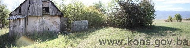
overlooked in any future investigations. The necropolis is overgrown with
ground plants and brambles, and the stećaks are partly or entirely sunken and
covered with moss. The left branch of Aerodromska
Street crosses the eastern part of the necropolis.
The
necropolis at Crnač was found to contain 54 graves with stećaks(10), 51 chest-shaped and three
gabled or sarcophagus shaped. They form three groups, lying west-east and
southwest-northeast. The stećaks are undecorated. The roof pane of gabled
stećak no. 6 bears an epitaph showing that it marks the grave of Bogčin, only
son of prince Stipko Ugarčić "on his noble land," and that the
epitaph was written by Ugarak.
Condition of the stećaks
Stećak
no. 1. – chest, undecorated, partly sunken, covered with lichen and moss,
lying northwest-southeast; the stećak measures 230x122x42 cm.
Stećak
no. 2. – chest, undecorated, damaged – part of the stećak broken off,
covered with lichen and moss, lying northwest-southeast; the stećak measures
140x154x92 cm.
Stećak
no. 3. – chest, undecorated, covered with lichen and moss, lying
northwest-southeast; the stećak measures 160x95x48 cm.
Stećak
no. 4. – chest, undecorated, covered with topsoil, covered with lichen
and moss, lying southwest-northeast; the stećak measures 242x140x56 cm.
Stećak
no. 5. – chest, undecorated, covered with topsoil, covered with lichen
and moss, lying southwest-northeast; the stećak measures 204x154x47 cm.
Stećak
no. 6. – gabled, undecorated, but with epitaph, sunken to roof height,
covered with lichen and moss, lying southwest-northeast; the stećak measures
248x138x62 cm.
The
south-east side of the roof pane bears the following epitaph
1. † a se
leži bogčinь kьneza stipka uga-
rьč]ića
2. sinь
na sьboѣoi zem-
Li na
plemenitoi
3. družio
žalite me
Mladь si
sega sbita
4.
otidohь a edьnь bihь
U maike
5. a se pisa ugarakь
“Here
lies Vogčinь (Bogčinь), son of prince Stipko U[garьč]ić, on his noble land.
Friend, pity me. I departed this life young, and was my mother’s only [son].
Written by Ugarakь.”(11)
Stećak
no. 7. – chest, undecorated, sunken, damaged and covered with lichen and
moss, lying southwest-northeast; the stećak measures 188x150x46 cm.
Stećak
no. 8. – chest, undecorated, leaning to the south-east and sunken,
covered with lichen and moss, lying southwest-northeast; the stećak measures
288x150x100 cm.
Stećak
no. 9. – chest, undecorated, partly sunken, covered with dry leaves,
covered with lichen and moss, lying southwest-northeast; the stećak measures
302x178x111 cm.
Stećak
no. 10. – chest, undecorated, partly sunken, covered with dry leaves,
covered with lichen and moss, lying southwest-northeast; the stećak measures
245x162x55 cm.
Stećak
no. 11. – chest, undecorated, broken in half, covered with lichen and moss,
lying southwest-northeast; the south-west half of the stećak measures
150x102x129 cm; the north-east half of the stećak measures 90x102x129 cm.
Stećak
no. 12. – chest, undecorated, covered with lichen and moss, lying
southwest-northeast; the stećak measures 256x140x44 cm.
Stećak
no. 13. – gabled undecorated, damaged, covered with lichen and moss,
lying southwest-northeast; the stećak measures 156x70x74 cm.
Stećak
no. 14. – chest, undecorated, leaning to the south-east and sunken,
covered with lichen and moss, lying southwest-northeast; the stećak measures
194x84x97 cm.
Stećak
no. 15. – gabled with plinth, undecorated, sunken to plinth height,
covered with lichen and moss, lying southwest-northeast; the stećak measures 204x92x122
cm; the visible width of the plinth is 144 cm.
Stećak
no. 16. – chest, undecorated, overturned onto its north-west side and
probably moved from its original position when the road was laid, sunken,
covered with lichen and moss, lying southwest-northeast; the stećak measures
222x118x97 cm.
Stećak
no. 17. – chest, undecorated, sunken, part broken off the south-west end,
covered with lichen and moss, lying southwest-northeast; the stećak measures
170x119x42 cm.
Stećak
no. 18. – chest, undecorated, sunken, visible part covered with lichen
and moss, lying southwest-northeast; the stećak measures 170x92x12 cm.
Stećak
no. 19. – chest, undecorated, earth piled up on the north-west side,
sunken, covered with lichen and moss, lying southwest-northeast; the stećak
measures 155x55x19 cm.
Stećak
no. 20. – chest, undecorated, sunken, covered with lichen and moss, lying
southwest-northeast; the stećak measures 160x108x22 cm.
Stećak
no. 21. – chest, undecorated, sunken, covered with lichen and moss, lying
southwest-northeast; the stećak measures 170x67x22 cm.
Stećak
no. 22. – chest, undecorated, sunken, covered with lichen and moss, lying
southwest-northeast; the stećak measures 137 cm long x68x22 cm.
Stećak
no. 23. – chest, undecorated, sunken, covered with topsoil, lying
southwest-northeast.
Stećak
no. 24. – chest, undecorated, covered with lichen and moss, lying
southwest-northeast; the stećak measures 198x98x35 cm.
Stećak
no. 25. – chest, undecorated, covered with lichen and moss, lying
southwest-northeast; the stećak measures 218x118x47 cm.
Stećak
no. 26. – chest, undecorated, sunken, covered with lichen and moss, lying
southwest-northeast; the stećak measures 160x65x16 cm.
Stećak
no. 27. – chest, undecorated, covered with topsoil and sunken, covered
with moss and lichen, lying southwest-northeast; the stećak measures 200x100x3
cm.
Stećak
no. 28. – chest, undecorated covered with topsoil and sunken, covered
with moss and lichen, lying southwest-northeast; the stećak measures 168x78x18
cm.
Stećak
no. 29. – chest, undecorated, overgrown with brambles, covered with
lichen and moss, lying southwest-northeast; the stećak measures 190x104x36 cm.
Stećak
no. 30. – chest, undecorated, overgrown with brambles, covered with
lichen and moss, lying southwest-northeast; the stećak measures 160x50x50 cm.
Stećak
no. 31. – chest, undecorated, overgrown with brambles and sunken, covered
with lichen and moss, lying west-east; the stećak measures 110x86x45 cm.
Stećak
no. 32. – chest, undecorated, sunken, covered with lichen and moss, lying
southwest-northeast.
Stećak
no. 33. – chest, undecorated, covered with topsoil, covered with lichen
and moss, lying southwest-northeast; the stećak measures 203x80x20 cm.
Stećak
no. 34. – chest, undecorated, covered with topsoil, covered with lichen
and moss, lying southwest-northeast; the stećak measures 200x77x40 cm.
Stećak
no. 35. – chest, undecorated, covered with topsoil, covered with lichen
and moss, lying southwest-northeast; the stećak measures 190x95x13 cm.
Stećak
no. 36. – chest, undecorated, leaning to the east, covered with lichen
and moss, lying north-south; the stećak measures 200x54x24 cm.
Stećak
no. 37. – chest, undecorated, covered with lichen and moss, lying
west-east; the stećak measures 160x70x20 cm.
Stećak
no. 38. – chest, undecorated, covered with lichen and moss, lying
west-east; the stećak measures 200x86x40 cm.
Stećak
no. 39. – chest, undecorated, covered with topsoil and dry leaves,
covered with lichen and moss, lying west-east; the stećak measures 210x104x26
cm.
Stećak
no. 40. – chest, undecorated, covered with topsoil and dry leaves,
covered with lichen and moss, lying west-east; the stećak measures 210x97x36
cm.
Stećak
no. 41. – chest, undecorated, covered with topsoil and dry leaves,
covered with lichen and moss, lying west-east; the stećak measures 188x117x40
cm.
Stećak
no. 42. – chest, undecorated, leaning to the south, covered with topsoil
and dry leaves, covered with lichen and moss, lying west-east; the stećak
measures 236x130x45 cm.
Stećak
no. 43. – chest, undecorated, leaning to the north, covered with topsoil
and dry leaves, covered with lichen and moss, lying west-east; the stećak
measures 215x80x80 cm.
Stećak
no. 44. – chest, undecorated, covered with lichen and moss, lying
southwest-northeast; the stećak measures 195x89x40 cm.
Stećak
no. 45. – chest, undecorated, sunken, covered with lichen and moss, lying
west-east; the stećak measures 177x80x55 cm.
Stećak
no. 46. – chest, undecorated, covered with earth and grass, visible part
covered with lichen and moss, lying northwest-southeast; the stećak measures
195x110x20 cm.
Stećak
no. 47. – chest, undecorated, covered with earth and grass, visible part
covered with lichen and moss, lying northwest-southeast; the stećak measures
190x100x22 cm.
Stećak
no. 48. – chest, undecorated, completely sunken, lying
northwest-south-east.
Stećak
no. 49. – chest, undecorated, sunken, overgrown with grass, covered with
moss and lichen, lying northwest-southeast; the stećak measures 175x70x5 cm.
Stećak
no. 50. – chest, undecorated, partly covered with scattered earth visible
part covered with lichen and moss, lying northwest-southeast; the stećak
measures 234x170x5 cm.
Stećak
no. 51. – chest, undecorated, sunken, covered with lichen and moss, lying
northwest-southeast; the stećak measures 170 cm long x 75 cm wide.
Stećak
no. 52. – chest, undecorated, sunken, covered with lichen and moss, lying
southwest-northeast; the stećak measures 120x60x5 cm.
Stećak
no. 53. – chest, completely sunken, overgrown with grass, covered with
moss and lichen.
Stećak
no. 54. – chest, undecorated, covered with lichen and moss, lying
west-east; the stećak measures 180x96x46 cm.
3. Legal status to date
During
the procedure prior to the adoption of a final decision on designation, the
records of protection of the property were inspected, and the findings are as
follows:
The
Regional Plan for BiH to 2000 lists six sites of necropolises with stećci (a
total of 332 stećci) in Ilidža
Municipality as Category
III monuments, without identifying them in detail(12).
A letter
from the Cantonal Institute for the Protection of the Cultural, Historical and
Natural Heritage, Sarajevo,
ref. 07-40-4-5148-1/12 of 10 September 2012, states that the property is listed
as follows:
Crnač,
Donji Kotorac, Ilidža, Sarajevo.
Roman
building and mediaeval necropolis at Crnač, next to the old aerodrome at
Butmirsko polje, necropolis with 59 stećaks.
Late
mediaeval.
Roman
building, i.e. remains of building materials, located in the necropolis of
stećaks.
The
property was not inscribed in the Register of Cultural Monuments of the
Socialist Republic of Bosnia and Herzegovina.
Letter
ref. 1078/-1/12 of 18 October 2012 from the Cantonal Institute for the
Protection of the Cultural and Natural Heritage of Sarajevo states that the
necropolis with stećaks at Crnač has the legal status of a cultural monument
pursuant to Ruling no. VMA-495/11 of 28 August 1977, rendered by the Sarajevo
City Institute for the Protection and Preservation of Cultural Monuments
The property is on the list of
recorded and previously protected immovable cultural monuments and natural
heritage of Sarajevo Canton, compiled by the Sarajevo Cantonal Institute for
the Protection of the Cultural and Natural Heritage, under serial no.
9103036Z-5.
4. Research and conservation and
restoration works
Research
consisting of recording the stećaks was conducted by Šefik Bešlagić, and
published in 1971. The inscription was studied by Ć. Truhelka and
published in 1895, and by M. Vego, who published in 1970.
5. Current condition of the
property
The
findings of on-site inspections on 24 September and 3 October 2012
are as follows:
-
the site of the necropolis
becomes overgrown with grass, brambles and ground plants with the resumption of
plant growth
-
in all 54 stećaks were
recorded, forming three groups, some partly or entirely sunken. The lie of the
land suggests that there could be more of them
-
the stećaks are at risk of
rapid deterioration from neglect
-
the stećaks are covered to
a greater or lesser extent with plant organisms (lichen and moss) which are
breaking down the structure of the stone
-
the sunken stećaks could
not be measured
6. Specific risks
-
deterioration of the site
as a result of long-term neglect
-
adverse effects of the
elements
-
self-sown vegetation
III – CONCLUSION
Applying
the Criteria for the adoption of a decision on proclaiming an item of property
a national monument (Official Gazette of BiH nos. 33/02 and 15/03), the
Commission has enacted the Decision cited above.
The
Decision was based on the following criteria:
A. Time frame
B. Historical value
C. Artistic and aesthetic value
C.i. quality of workmanship
C.iii. proportions
C.v. value of details
D. Clarity
(documentary, scientific and educational value)
D.i. material evidence of a lesser known
historical era
E. Symbolic value
E.ii. religious value
E.iii. traditional value
E.v. significance for the identity of a group of
people
G. Authenticity
G.i. form and design
G.ii. material and content
G.iii. use and function
G.iv. traditions and techniques
G.v. location and setting
The
following documents form an integral part of this Decision:
-
Ownership documentation
-
letter ref.
21.63-952.1-1-208/2012 of 3 October 2012 from the Department of Geodetics and
Proprietary Rights Banja Luka, East Ilidža
branch, supplying the Commission with cadastral details, a copy of cadastral
plan no. L. D Sarajevo-53 for c.p. 1839 (new survey), 154/1, 155 (old survey),
and copy of title deed no. 661/2, cm. Butmir, East Ilidža
Municipality
-
letter ref.
065-0-Rz-11-4499 of 5 November 2012 from the Municipal Court in Sarajevo supplying the
Commission with Land Register entry no. 8051 for plot nos. 154/1 and 155, c.m.
SP Gornji Butmir.
-
Documentation on previous
protection of the property
-
letter ref.
07-40-4-5148-1/12 of 10 September 2012 from the Institute for the Protection of
Monuments under the Federal Ministry of Culture and Sport, supplying the
Commission to Preserve National Monuments with details of the record and
statutory protection status of the necropolis with stećaks at Crnač in Donji
Kotorac, Ilidža, Sarajevo
-
letter ref. 1078/-1/12 of
18 October 2012 from the Cantonal Institute for the Protection of the Cultural
and Natural Heritage of Sarajevo supplying the Commission with details of the
statutory protection, history and significance of the property, the value
accorded to it and its stylistic features, with photographs.
-
Photodocumentation
-
photographs of the property
taken on 24 September 2012 by historian Zijad Halilović using Canon EOS 450D
digital camera.
-
Technical documentation
-
Survey of the property
(plan of the necropolis, survey of the monuments) measured and surveyed on 24
September and 3 October 2012 by Zijad Halilović, staff specialist for
archaeology, and Milka Grujić, freelance associate.
Bibliography
During
the procedure to designate the monument as a national monument of Bosnia
and Herzegovina the following works were
consulted:
1896. Truhelka, Ćiro. “Sredovjeki natpis u Kotorcu” (A mediaeval
epitaph in Kotorac). Sarajevo:
GZM, 1896, 217, 218.
1970. Vego, Marko. Zbornik srednjovjekovnih natpisa Bosne i
Hercegovine (Collected mediaeval inscriptions and epitaphs of BiH). Sarajevo: National
Museum, 1970.
1971. Bešlagić, Šefik. Stećci, kataloško-topografski pregled
(Stećak tombstones, a catalogue-cum-topographical survey). Sarajevo: 1971, 177.
1973. Anđelić, Pavao. Bobovac i Kraljeva Sutjeska (Stolna mjesta
bosanskih vladara u XIV i XV vijeku) (Bobovac and Kraljeva Sutjeska
[capitals of the Bosnian rulers in the 14th and 15th centuries). Sarajevo: Veselin
Masleša, 1973, 222, 223.
1980. Various authors. Prostorni plan Bosne i Hercegovine, faza b –
valorizacija, prirodne i kulturno-historijske vrijednosti. Sarajevo: Institut
za arhitekturu, urbanizam i prostorno planiranje Arhitektonskog fakultet u
Sarajevu i Urbanistički zavod za Bosnu i Hercegovinu Sarajevo (Regional plan
for BiH phase B – valorization of natural and cultural assets), Institute of
Architecture, Urbanism and Planning, Faculty of Architecture in Sarajevo, and
Planning Institute for BiH, Sarajevo), 1980.
1985. Skarić, Vladislav. Sarajevo
i njegova okolina od najstarijih vremena do austrougarske okupacije. Sarajevo: Izabrana djela,
knj. I (Sarajevo
and environs from ancient times to the Austro-Hungarian occupation. Selected
Works, vol. 1), 1985, 37-42.
1988. Arheološki leksikon (Archaeology lexicon), vol. I.
Sarajevo: Zemaljski muzej Bosne i Hercegovine, 1988, 42.
1997. Mušeta Ašćerić, Vesna. “Srednjovjekovna naselja na mjestu
današnjeg Sarajeva u Prilozima istoriji Sarajeva” (Mediaeval settlements in
present-day Sarajevo in Contributions to the
history of Sarajevo).
Sarajevo: papers from symposium “Pola milenija
Sarajeva” (Half a millennium of Sarajevo),
held from 19 to 21 March 1993. Institut za istoriju i Orijentalni institut,
1997, 36.
2005. Mušeta Ašćerić, Vesna. Sarajevo
i njegova okolina u XV stoljeću. Između istoka i zapada (Sarajevo and its Environs in the 15th
Century. Between East and West). Sarajevo: 2005,
16-19 + map of counties in the Sarajevo
area in the first half of the 15th century.
www.google
earth.com (11 October 2012)
(1) Skarić,
Vladislav, Sarajevo i njegova okolina
od najstarijih vremena do austrougarske okupacije, Sarajevo: Izabrana djela, knj. I, 1985, 37-42.
(2) Anđelić, Pavao,
Bobovac i Kraljeva Sutjeska (Stolna mjesta bosanskih vladara u XIV i XV
vijeku), Sarajevo:
Veselin Masleša, 1973, 222.
(3) Anđelić,
Pavao, Ibidem, Sarajevo:
Veselin Masleša, 1973, 222, 223.
(4) Mušeta-Aščerić,
Vesna, “Srednjovjekovna naselja na mjestu današnjeg Sarajeva,” u Prilozima
istoriji Sarajeva, Sarajevo:
Radovi sa naučnog simpozijuma «Pola milenija Sarajeva» održanog od 19. do 21
marta 1993. godine, Institut za istoriju i Orijentalni institut, 1997, 36.
(5) Mušeta-Aščerić,
Vesna, Sarajevo i njegova okolina u XV
stoljeću, između zapada i istoka, Sarajevo:
Sarajevo Publishing, 2005, 16–19. + Karta – Župe sarajevskog područja u prvoj
polovini XV stoljeća.
(6) Vego, Marko, Zbornik
srednjovjekovnih natpisa Bosne i Hercegovine IV, Sarajevo:
Izdanje Zemaljskog muzeja Sarajevo, 1970, 12,
13; Truhelka, Ćiro, “Sredovjeki natpis u Kotorcu,” Sarajevo: GZM, 1896, 217, 218.
(7) Bešlagić,
Šefik, Stećci, kataloško-topografski pregled, Sarajevo: Veselin Masleša, 1971, 173-177.
(8) www.google
earth.com (11 October 2012)
(9) Arheološki
leksikon Bosne i Hercegovine, Tom III, Sarajevo:
Zemaljski muzej Bosne i Hercegovine, Sarajevo,
1988, 42.
(10) In the Arheološki
leksikon and Š. Bešlagić the number of stećaks is stated to be 59; Arheološki
leksikon Bosne i Hercegovine, Tom III, 1988, 42; Bešlagić, Šefik, Stećci,
1971, 177.
(11) Vego, Marko, Zbornik
srednjovjekovnih natpisa Bosne i Hercegovine IV, Sarajevo:
Izdanje Zemaljskog muzeja Sarajevo,
1970, 13.
(12) Various
authors, Prostorni plan Bosne i Hercegovine, faza b – valorizacija, prirodne
i kulturno-historijske vrijednosti, Sarajevo:
Institut za arhitekturu, urbanizam i prostorno planiranje Arhitektonskog
fakultet u Sarajevu i Urbanistički zavod za Bosnu i Hercegovinu Sarajevo, 1980,
51.
|