Status of monument -> National monument
Pursuant to Article V para. 4 Annex 8 of the General Framework Agreement for Peace in Bosnia and Herzegovina and Article 39 para. 1 of the Rules of Procedure of the Commission to Preserve National Monuments, at a session held from 6 to 11 December 2003 the Commission adopted a
D E C I S I O N
I
The historic site of the Old Fort of Blagaj (Stjepan grad) in Blagaj near Mostar is hereby designated as a National Monument of Bosnia and Herzegovina (hereinafter: the National Monument).
The National Monument is located on part of cadastral plot 1546 and part of c.p. 3768 (the approach road to the old fort), and parts of c.p. nos. 3025, 3768 and 3769 (the Šehid’s cemetery), cadastral municipality Blagaj, city of Mostar, urban area South-East, Federation of BiH, Bosnia and Herzegovina.
The National Monument consists of the old fort of Blagaj, the Šehitska or martyrs’ necropolis and the movable heritage items discovered on the archaeological site, now in the Museum of Herzegovina in Mostar and the National Museum of Bosnia and Herzegovina in Sarajevo and listed in the inventory records of the museums.
The provisions relating to protection and rehabilitation measures set forth by the Law on the Implementation of the Decisions of the Commission to Preserve National Monuments, established pursuant to Annex 8 of the General Framework Agreement for Peace in Bosnia and Herzegovina (Official Gazette of the Federation of BiH nos. 2/02, 27/02 and 6/04) shall apply to the National Monument.
II
The Government of the Federation of Bosnia and Herzegovina (hereinafter: the Government of the Federation) shall be responsible for ensuring and providing the legal, scientific, technical, administrative and financial measures necessary to protect, conserve, display and rehabilitate the National Monument.
The Government of the Federation shall be responsible for providing the resources for drawing up and implementing the necessary technical documentation for the rehabilitation of the National Monument.
The Commission to Preserve National Monuments of Bosnia and Herzegovina (hereinafter: the Commission) shall determine the technical requirements and secure the funds for preparing and setting up signboards with the basic data on the monument and the Decision to proclaim the property a National Monument.
III
To ensure the on-going protection of the National Monument, the following measures are hereby stipulated:
Protection Zone I consists of the site of the old fort of Blagaj as defined in Clause 1 para 2 of this Decision.
Ÿ In this Zone only research works and conservation and restoration works shall be permitted, including those designed to display the monument, with the approval of the Federal Ministry responsible for regional planning and under the expert supervision of the heritage protection authority of the Federation of Bosnia and Herzegovina
Ÿ The site shall be open and accessible to the public and may be used for educational and cultural purposes.
Ÿ No construction, timber felling, or works that could have the effect of altering the site, or the erection of temporary facilities or permanent structures not designed solely for the protection and display of the National Monument shall be permitted.
Ÿ The dumping of all kinds of waste is prohibited.
The Government of the Federation shall be responsible in particular for ensuring that the following measures are implemented:
Ÿ drawing up and implementing a programme for the display of the National Monument
Ÿ clearing the walls of vegetation that is a danger to the structure of the monument,
Ÿ clearing the interior of the mosque of deposits of earth and the removal of partition walls and fallen sections of dry walling from the interior of the mosque,
Ÿ structural repairs and consolidation of damaged walls, including the east wall, the part of the wall above the main entrance, parts of the east wall on the inside, the west wall of the palace, the steps to the doksat (oriel) tower, and the walls of the mosque
Ÿ conservation of the existing condition of the ramparts and towers of the old fort
Ÿ the identification, recording and rebuilding on its original site of all fallen rubble from the walls
Ÿ the appropriate display within the ensemble of all fragments that are too badly damaged to be reintegrated
Ÿ the shehids' necropolis shall be made good and damaged nišan tombstones repaired
Protection Zone II consists of an area with a radius of 1 km from the protected monument as specified in Clause 1 of this Decision.
In Protection Zone II the construction of quarries, potential environmental polluters, major infrastructure or any structures that during construction or operation could endanger the monument (aesthetically, functionally, structurally, chemically etc.) is prohibited.
IV
The removal of the movable items specified in Clause 1 of this Decision (hereinafter: the movable items) is prohibited.
y way of exception to the provisions of paragraph 1 of this Clause, the temporary removal from Bosnia and Herzegovina of the movable items for the purposes of display or conservation shall be permitted if it is established that conservation works cannot be carried out in Bosnia and Herzegovina.
Permission for their temporary removal from Bosnia and Herzegovina under the conditions stipulated in the preceding paragraph shall be issued by the Commission to Preserve National Monuments, if it is determined beyond doubt that it will not jeopardize the movable items in any way. In granting permission for the temporary removal of the items, the Commission shall stipulate all the conditions under which the removal may take place, the date by which the items shall be returned to Bosnia and Herzegovina, and the responsibility of individual authorities and institutions for ensuring that these conditions are met, and shall notify the Government of the Federation of Bosnia and Herzegovina, the relevant security service, the customs authority of Bosnia and Herzegovina, and the general public accordingly.
V
All executive and area development planning acts not in accordance with the provisions of this Decision are hereby revoked.
VI
Everyone, and in particular the competent authorities of the Federation of Bosnia and Herzegovina, the Canton, and urban and municipal authorities, shall refrain from any action that might damage the National Monument or jeopardize the preservation and rehabilitation thereof.
VII
The Government of the Federation, the Federal Ministry responsible for regional planning, the Federation heritage protection authority, and the Municipal Authorities in charge of urban planning and land registry affairs, shall be notified of this Decision in order to carry out the measures stipulated in Articles II to VI of this Decision, and the Authorized Municipal Court shall be notified for the purposes of registration in the Land Register.
VIII
The elucidation and accompanying documentation form an integral part of this Decision, which may be viewed by interested parties on the premises or by accessing the website of the Commission (http://www.aneks8komisija.com.ba)
IX
Pursuant to Art. V para 4 Annex 8 of the General Framework Agreement for Peace in Bosnia and Herzegovina, decisions of the Commission are final.
X
This Decision shall enter into force on the date of its adoption and shall be published in the Official Gazette of BiH.
This Decision has been adopted by the following members of the Commission: Zeynep Ahunbay, Amra Hadžimuhamedović, Dubravko Lovrenović, Ljiljana Ševo and Tina Wik.
Chair of the Commission
Ljiljana Ševo
No: 06-6-1029/03-5
6 December 2003
Sarajevo
E l u c i d a t i o n
I – INTRODUCTION
Pursuant to Article 2, paragraph 1 of the Law on the Implementation of the Decisions of the Commission to Preserve National Monuments, established pursuant to Annex 8 of the General Framework Agreement for Peace in Bosnia and Herzegovina, a “National Monument” is an item of public property proclaimed by the Commission to Preserve National Monuments to be a National Monument pursuant to Articles V and VI of Annex 8 of the General Framework Agreement for Peace in Bosnia and Herzegovina and property entered on the Provisional List of National Monuments of Bosnia and Herzegovina (Official Gazette of BiH no. 33/02) until the Commission reaches a final decision on its status, as to which there is no time limit and regardless of whether a petition for the property in question has been submitted or not.
At a session held on 1-2 July 1999 the Commission issued a Decision to add the historic site of Blagaj Old Fort (Stjepan grad) in Blagaj on the Buna, Blagaj municipality, to the Provisional List of National Monuments of Bosnia and Herzegovina, numbered as 413.
Pursuant to the provisions of the law, the Commission proceeded to carry out the procedure for reaching a final decision to designate the Property as a National Monument, pursuant to Article V of Annex 8 and Article 35 of the Rules of Procedure of the Commission to Preserve National Monuments.
II – PROCEDURE PRIOR TO DECISION
In the procedure preceding the adoption of a final decision to proclaim the property a national monument, the following documentation was inspected:
Ÿ Documentation on the location and current owner and user of the property (copy of cadastral plan and copy of land registry entry)
Ÿ Data on the current condition and use of the property, including a description and photographs, data of war damage, data on restoration or other works on the property, etc.
Ÿ Historical, architectural and other documentary material on the property, as set out in the bibliography forming part of this Decision.
The findings based on the review of the above documentation and the condition of the site are as follows:
1. Details of the property
Location
The old fort of Blagaj (Bona, Stjepan grad) was bult on the most prominent part of a high, inaccessible karst hill, at an altitude of 310 m above sea level, above the source of the river Buna 266 m away.
Historical information
The archaeological material scattered above the slopes of Blagaj hill is evidence that there were settlements here in the prehistoric and Roman periods. The summit, which forms an elongated triangle measuring 900 x 900 x 500 m, has the remains of fortifications on each of its highest points. On the north-eastern summit, there are the remains of a Roman or late antique fortification or observation post (specula, burgus) known as Mala gradina, and on the south-eastern summit the contours of a prehistoric hillfort can be discerned. On the south-western summit are the remains of the present day Stjepan grad, a mediaeval or Ottoman period fort. The shorter sides of the triangle are bordered by a gorge through which a river once flowed, and on the longer and only accessible side the remains of solid, massive ramparts can be seen, enclosing a fortified town complex of more than 2 ha in area. It is possible that this complex consisted of two parts in the early mediaeval period – the Old Fort (Stjepan grad) and Mala gradina, and that this twin settlement lasted at least to the mid tenth century. The earliest indirect source in writing on the forts of Zahumlja, including Blagaj, is the Treatise on Peoples by the Byzantine Emperor and writer Constantine Porphyrogenitus, dating from between 948 and 952, in which two forts are referred to – Bona and Hum.
After the tenth century, too, Blagaj played a large part in the development of Hum or Zahumlje. A major influence on its development and importance was the proximity of a major route linking the Adriatic sea with the Bosnian hinterland via the Neretva valley (“via Narenti”). Turbulent political events, particularly after the tenth century, did not have any essential impact on the economic development of the town outside the ramparts. The prince of Hum, Miroslav, in whose time the church of SS Cosmos and Damian was built, held court in Blagaj (Orbini, II Regno, 350). A plaque with an inscription in Cyrillic, found in 1912 near the ruins of the local manor of Bišća and the locality Vrači records the erection of the church (Vego, 1957, 15). The plaque is now in the National Museum of Bosnia and Herzegovina.
By the time of King Tvrtko, Bosnian rulers were issuing charters in Blagaj, and in May 1404 Blagaj became one of the residences of duke (vojvoda) Sandalj Hranić, and then of count (herzeg) Stjepan Vukčić Kosača, after whom the fort was named Stjepan grad by the people. The first source in writing in which there is reference to it is a peace accord between duke Sandalj Hranić and the Venetians, dated 1 November 1423, issued “in our town of Blagaj”. In the 15th century it is referred to in three charters of the King of Aragon and Naples, Alphonse V.
The Ottomans occupied Blagaj in 1465, and by 1473 there is already reference to the kadija of Blagaj. They repaired the fort twice: in 1699, when the west tower was repaired, and again in 1827. There was a garrison stationed there until 1835, although the fort’s former strategic role had long since been taken over by Mostar.
2. Description of the property
Unlike other fortifications that were also rulers’ residences in Bosnia and Herzegovina, the Blagaj fort is situated on a naturally level site above vertical cliffs to the south, west and north. The ground plan of the fort is an irregular polygon, logically adapted to the configuration of the terrain. The approach route, a steep serpentine bridle path 2 m wide and 900 m long, leads to the entrance in the most solidly built east wall of the forecourt. The walls have survived in large part of 12 or 14 m in height, and ranging in thickness from 1.5 to 2.0 m, while on the south they are no thicker than 1.5 m. The inner defended space is a relatively small area of about 1700 sq.m., similar to the fort in Jajce.
The entrance to the fortified town was protected by an outer forecourt that is now hard to discern, a forecourt (VII, measuring 10 x 11.5 m) and a gatehouse (VII, measuring 10 x 7 m) as the final obstacle to attackers attempting to enter the fort. The walls of the gatehouse are markedly more solid and higher than those of the forecourt.
From the defensive point of view, the most important wall is the east wall with its three projecting towers (I, II, III) measuring 7 x 6 m, 6 x 6 m and 6 x 5.5 m respectively. Basler is of the that the towers were reinforced by low buttresses in the fourth century – these have survived to this day. There was another tower at each end (IV and IX), which served to prevent the enemy gaining access to the less well defended parts of the fort. Large semicircular openings on the inner wall of the tower, probably dating from the late antique period, were retained in later alterations, and were used for bringing in weapons. In the sixth century most of the walls were increased in height although their dimensions remained unchanged. In the mediaeval period the entire mass was considerable increased by building on, and it is not impossible that some of the lower parts of the tower collapsed. The breastworks may not have been built up to their original height, but somewhat lower (Basler, 1983, 32). In the late 14th and early 15th century, the walls were reinforced and thickened by being built on to, with the additional walling narrowing from base to top. About ten metres from the fort yet another wall was built, do that the space between them gives the impression of a trench. The east wall was particularly badly damaged in the 18th or early 19th century when a large quantity of gunpowder exploded in the middle tower. Repairs were carried out rather clumsily and carelessly, considerably altering the original appearance (Basler, 1983). Anđelić, who conducted excavations in 1965, writes: “As a detailed result of the excavations, it turned out that the fort had no remains of antique or late antique architecture” (Anđelić, 1965, 179).
To the west, where the bailey narrows, a square tower was built, the so-called “fortress doksat” (V), measuring 8 x 4.5 m. Stone steps led to the top, from which there is a fine and extensive view of the surrounding countryside. A little further south, on the inside, is another tower (XVI) measuring 10 x 10 m. A secret passage was left in the south wall, former hidden by a stairway and semicircular wall, used to abandon the fort in case of danger.
Among the architectural features discovered, the most significant were the remains of a palace (XV), of irregular rectangular outline: 13.20 x 7.8 and 11.90 x 8 m. The walls have survived in places to a height of 2.10 m, and are about 1.30 m thick. To the north was a portico which narrowed from west to east from 2.00 to 1.40 m. A piece of the wall of the porch 40 cm thick had survived to a height of 0.80 m. The interior was half timbered, as may be deduced from the large quantities of charred beams and half-baked clay. The building had had sculptural decorations, as evidenced by the discovery of a fragment of the capital of a pilaster. Based on the nature of the building, archaeological material and relevant analogies, it was concluded that the palace dated from the late 14th or early 15th century, during the time of duke Sandalj Hranić. There were two cisterns built against the palace (XIII and XIV) measuring 2.8 x 2 and 8 x 4.4 metres, which had been roofed with barrel vaults in the mediaeval period.
To the right of the gatehouse was a single-storey building measuring 10 x 5.5 m, with a stone vaulted roof. The assumption is that the basement was once used as a prison cell or treasury, and the floor above to house a guard.
The central area is occupied by a building (XII) measuring 15 x 15 m, with a built-in circular cistern with a diameter of 6 m, and 7 m deep. This was probably built in the Ottoman period (Anđelić, 1965, 179). It was then, too, that the mosque (X), measuring 8 x 5 m, and a small house (XI) measuring 9 x 4 m were built, although they remained in use for a relatively short time, since the Ottoman garrison preferred to live in the settlement below the fort. In his 1664 travelogue, Evliya Çelebi refers to an iron gate, fifteen deserted houses, a small mosque, two cisterns and two cannon, and says of the fort that “it looks as though it had just emerged from the hand of the master builder”(Çelebi, 1979, 459).
A comparison of the structure of the walls enables one to track the various stages of construction and repair from the earliest beginnings of the fort in the fourth century. The walls of the first stage of construction are of quarry stone, laid in horizontal layers 20 cm thick (opus incertum), similar to the palace in Mogorjelo. In the second stage, which lasted between 535 and 600, the walls were repaired and in places built up to a height of 1-3 m, using the technique of stone laid slantwise in courses of 20-25 cm (opus spicatum). This technique is associated with the reign of the Emperor Justinian (527-565). Repairs to the central tower of the east wall are dated to the 6th century. The type and extent of the interventions dating from the 7th to the 15th century are hard to determine because of later repairs, conducted in opus incertum right up to the 19th century. After the 16th century, all works on the fort were carried out by local dunđeri (all-round builders who would turn their hand equally to masonry or carpentry), which is ascribed to the abrupt fall in the strategic importance of the fort in the circumstances of the day.
Archaeological material
In 1965, systematic archaeological excavations were conducted under the supervision of the National Museum of Bosnia and Herzegovina. An area of about 1000 sq.m. was investigated, or rather more than one third of the area enclosed by the ramparts. The archaeological layers were characterized by considerable thickness (0.50 to 3.50 m) and by the sparsity of cultural material. In the mediaeval stratum (10-30 cm thick), pottery and small iron items were found, along with pieces of glass and charred grain. A large quantity of lead – about 700 kg – was found in the ruins of the palace or court. In the archaeological stratum dating from the Ottoman period, the only finds were pottery shards and small items of ironmongery used in building. As a result of the excavations, it was found that Blagaj had no remains of antique and early mediaeval architecture, nor was there any archaeological material from that period. A few shards of Illyrian pottery and a few small fragments of Roman roof tiles indicate the presence of the Illyrians on this prominent site (Anđelić, 1965, 178-180).
The shahids' necropolis in Blagaj Below the fort, by the road, is an old Muslim burial ground known as Šehitluk. The graves and tombstones are almost completely wrecked, although the outlines of several graves can still be discerned and there are eight, mostly damaged nišan tombstones to the left and right of the brook and approach road. Among the surviving tombstones, a pair made of white limestone stand out in particular. The headstone nišan, 2 m in height, is octagonal in cross section and has a “creased” turban, and the footstone is a simple stele. This is probably the oldest burial ground in Blagaj.
3. Legal status to date
Pursuant to the law, and by Ruling of the Institute for the Protection of Cultural Monuments of SRBiH no. 05-359-1/66 of 12.03.1966 in Sarajevo, the site of the Fortress Stjepan grad was placed under state protection.
The historic site of the Old Fort in Blagaj (Stjepan grad) is on the Provisional List of National Monuments as the Fortress Stjepan grad, no. 413.
The Regional Plan of BiH to 2000 listed it as a category I monument.
4. Research and conservation and restoration works
In 1910-1914, conservation works were carried out under the supervision of Vejsil Ćurčić. From 8 June to 18 October 1965, systematic archaeological excavations were carried out under the supervision of the National Museum of Bosnia and Herzegovina as part of a comprehensive project for the archaeological study of mediaeval forts in BiH. The Museum of Herzegovina was also partly involved in the works, which were led by Dr Pavao Anđelić. An area of about 1000 sq.m. was investigated, or rather more than one third of the area enclosed by the ramparts.
Between 25 September and 5 November 1990, archaeological investigations were carried out under the guidance of Dr A. Ratković. The movable archaeological material was deposited in the fortress and partly in the ruinous premises of RO Prostor, Republic of Yugoslavia Institute for the Protection and Use of the Cultural and Historical Heritage “Stari grad” Mostar.
Between 1990 and 1991, the majority of the archaeological material was transferred from the National Museum of Bosnia and Herzegovina to the Museum of Herzegovina in Mostar. Part of the movable material, together with the records of the archaeological excavations, is in the National Museum.
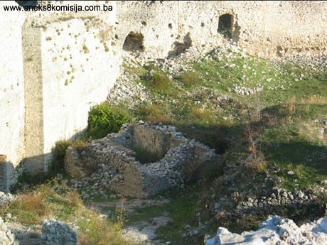
5. Current condition of the property
An on site inspection in November 2003 ascertained as follows:
Part of the road to the base of the fort has been asphalted. A steep path leads from the base, which is overgrown with vegetation here and there. As a whole the monument is in poor condition. In places the wall facing can be seen to have fallen away and the inner walls have shifted. In the last war the east wall was breached in places. The mosque has also been rebuilt with dry walling.
The following are particularly badly damaged:
1. East wall, part of the wall above the main entrance (surface area of about 10 sq.m.) parts of the east wall on the inside.
2. West wall of the palace (area of about 5 sq. m),
3. Stairway too doksat-tower (area of about 10 sq.m.),
4. Walls of the mosque
The on site inspection also revealed that the remaining nišan tombstones in the burial ground below the fort are damaged, broken and mostly shifted from the graves.
III – CONCLUSION
Applying the Criteria for the adoption of a decision on proclaiming an item of property a national monument (Official Gazette of BiH nos. 33/02 and 15/03), the Commission has enacted the Decision cited above.
The Decision was based on the following criteria:
A. Time frame
B. Historical value
C. Artistic and aesthetic value
C.iv. composition
C.vi. value of construction
D. Clarity
D.ii. evidence of historical change
F. Townscape/ Landscape value
F.ii. meaning in the townscape
F.iii. the building or group of buildings is part of a group or site
G. Authenticity
G.i. form and design
G.ii. material and content
G.v. location and setting
H. Rarity and representativity
H.i. unique or rare example of a certain type or style
The following documents form an integral part of this Decision:
- Copy of cadastral plan
- Photodocumentation;
- Drawings
Bibliography
During the procedure to designate the monument as a national monument of Bosnia and Herzegovina the following works were consulted:
Anđelić, Pavao, Blagaj-srednjevjekovni grad, (Blagaj mediaeval fort) Archaeological Review 7, Belgrade, 1965, 178-180
Anđelić, Pavao, Bišće i Blagaj, politički centar Humske zemlje u srednjem vijeku, (Bišće and Blagaj, political centre of Hum land in the middle ages) Hercegovina 1, Mostar, 1981, 41-71.
Basler, Đuro, Istočni zid grad Blagaja na Buni, (East wall of the Blagaj fort) Hercegovina 3, Mostar, 1983. 29-33
Brkljača, Seka, Iz srednjevjekovne istorije Blagaja, (From the mediaeval history of Blagaj) Hercegovina 9, Mostar, 1997,15-18
Çelebi, Evliya, Putopis, Sarajevo,1979
Kreševljaković, Hamdija and Kapidžić, Hamdija, Stari hercegovački gradovi, (Old Herzegovina towns) Naše starine II, Sarajevo, 1954, 9-22.
Ratković, Aleksandar, Blagajska tvrđava u svjetlu najnovijih istraživanja, (Blagaj fort in the light of recent investigations) Hercegovina 10, Mostar, 1998, 7-15.
Truhelka, Ćiro, Naši gradovi, opis najljepših sredovječnih gradova Bosne i Hercegovine, (Our towns, description of the finest mediaeval towns/forts of BiH) Sarajevo, 1904, 64-69
Vego, Marko, Naselja srednjevjekovne bosanske države, (Settlements of the mediaeval Bosnian state) Sarajevo, 1957, 14-16.
|